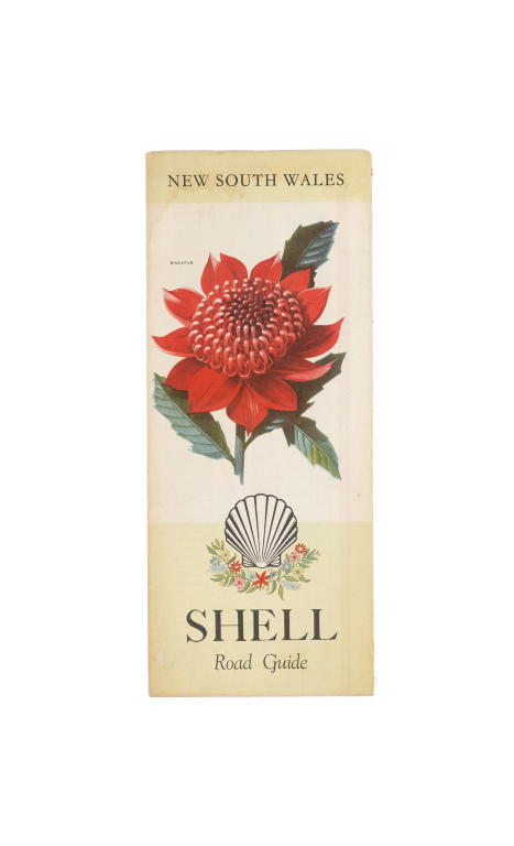
'Shell Road Guide: New South Wales' road map
Object No. 2011/73/1-5
This is one of a collection of five Shell fold-out road maps for travelling from Sydney to Brisbane, around New South Wales and the Newcastle District in the early 1960s. They were published by the Shell Touring Service of the Shell Oil Company of Australia Ltd. The Shell oil company began in Australia in 1901. At first fuel was supplied in tins, and then from 1921 Shell began to use motor tankers while bulk delivery to their roadside pumps began in 1926. The firm established an extensive fuel distribution network via inland fuel dumps and service stations or dealerships which enabled Australia to be traversed not only by the car but by plane. These Shell maps date from the early 1960s when the car was beginning to assume its high importance for independent and flexible travel, anywhere and anytime. It coincided with the post-World War Two baby boom, the decreasing costs of cars and increased wages. Family motoring holidays became available to all whereas between the wars rail travel and hotel accommodation were too expensive for the average Australian family. By the 1950s and 1960s those families were on the road and going on holiday to camping grounds and caravan parks. Shell maps or "road guides" were published to cover areas all over Australia. They advised not only road surfaces (most Australian road surfaces were unsealed then), but distances between towns, camping areas, bowling clubs and the location of Shell service stations. Children were given Shell passports which were stamped at each service station with a different picture, often related to the area. This provided an enjoyable memento from the holiday. In cars of the 1960s fuel economy was poor so frequent stops at service stations had to be made. The marked locations of Shell services stations on the maps of course encouraged families to frequent Shell outlets. The maps indicate the extensive infrastructure of fuel distribution attainable in only 20 to 30 years to enable motorists to criss-cross the country and travel to the most remote corners of Australia with the knowledge that they had access to fuel. With global warming and the reaching of peak oil a similar type of infrastructure will need to be established to cater for electric or hydrogen-powered vehicles. Now (in 2011) Global Positioning Systems are installed in many cars and on phones which removes the need to learn to read a map and manually navigate from place-to-place yet alone even have a map or road guide in the car. Margaret Simpson Curator, Transport & Toys July 2011 Barrie, Melinda, "Everybody Loves a Road Trip!" in the "UMA Bulletin News from the University of Melbourne Archives", No. 25, August 2009. Broomham, Rosemary, "Vital Connections: A History of NSW Roads from 1788", Hale and Iremonger in association with the Roads and Traffic Authority NSW, Alexandria, NSW, 2001. Simpson, Margaret, "On the move: a history of transport in Australia", Powerhouse Publishing, Sydney, NSW, 2004. The beginning of Shell in Australia http://www.shell.com.au/home/content/aus/aboutshell/who_we_are/history/au/ University of Melbourne Archives 'Everybody Loves a Road Trip: An exhibition of the Shell company' in 2009. http://www.lib.unimelb.edu.au/collections/archives/exhibitions/roadtrip/
Loading...
Summary
Object Statement
Road map (1 of 5), 'Shell Road Guide: New South Wales', paper, published by the Shell Touring Service, Shell Oil Company of Australia Ltd, printed by P C Grosser, Melbourne, Victoria, Australia, May 1963
Physical Description
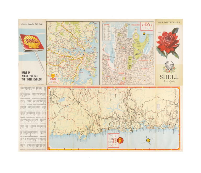
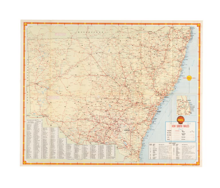
Fold-out coloured road map featuring an illustration of a waratah on the cover. On one side is a map of New South Wales showing the main sealed and unsealed roads, as well as minor roads and tracks, railways, bowling clubs, golf courses, homesteads, and total mileages and intermediate mileages between towns. The other side shows a town plan of the city of Sydney, a map showing the suburbs of Sydney and a detailed map covering Sydney, Newcastle and Canberra.
DIMENSIONS
Height
272 mm
Width
113 mm
PRODUCTION
Notes
This road map was published by the Shell Touring Service, part of the Shell Oil Company of Australia Ltd. It was printed by P.C. Grosser, lithographer of Melbourne in May1963.
SOURCE
Acquisition Date
26 August 2011

Copyright for the above image is held by the Powerhouse and may be subject to third-party copyright restrictions. Please submit an Image Licensing Enquiry for information regarding reproduction, copyright and fees. Text is released under Attribution-Non Commercial-No Derivative licence.
Image Licensing Enquiry
Object Enquiry